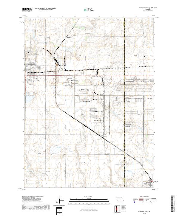
2021 Map of Hastings East
USGS Topo · Published 2021About this map
The eastern edges of Hastings define this landscape, where the urban grid of the city meets the expansive agricultural townships of south-central Nebraska. Higher education anchors the western portion of the sheet with the campuses of Hastings College and the Central Community College Hastings Campus. Outside the city center, the terrain is dotted with small residential clusters like Good Samaritan Village and the settlements of Blaine, Halloran, and Level. In the southeast, the village of Glenvil sits near the county line, marked by its local Glenvil Cem.
Find a feature on this map
79 named features on this map. Tap any name to fly to it.
Don’t see what you’re looking for? This feature index may not catch every label — zoom into the map to look around manually.
Map Details
Editions of this 2021 Hastings East Map
This is the sole edition of this map. No revisions or reprints were ever made.
Other maps of this area

1898 · Superior
USGS Topo · 1:125,000

1898 · Grand Island
USGS Topo · 1:125,000

1955 · Grand Island
USGS Topo · 1:250,000

1957 · Grand Island
USGS Topo · 1:250,000

1958 · Grand Island
USGS Topo · 1:250,000

1969 · Hastings East
USGS Topo · 1:24,000

1969 · Fairfield NW
USGS Topo · 1:24,000
1969 · Trumbull
USGS Topo · 1:24,000
1969 · Hastings West
USGS Topo · 1:24,000
1969 · Hastings NW
USGS Topo · 1:24,000