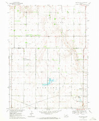
1969 Map of Hastings NW
USGS Topo · Published 1971About this map
Highland and South Platte townships meet on this 1969 survey, where the agricultural grid of Adams County is interrupted by the meandering Big Blue River. Near the Fish Hatchery and Kernan Lagoon, the landscape reflects a mix of water management and recreation, anchored by the Lochland Country Club. The Union Pacific railroad cuts across the southern portion of the map, providing a glimpse into the transportation network serving the rural community.
Find a feature on this map
21 named features on this map. Tap any name to fly to it.
Don’t see what you’re looking for? This feature index may not catch every label — zoom into the map to look around manually.
Map Details
Editions of this 1969 Hastings NW Map
2 editions found
Other maps of this area

1892 · Grand Island
USGS Topo · 1:62,500

1894 · Kenesaw
USGS Topo · 1:62,500

1895 · Grand Island
USGS Topo · 1:62,500

1895 · Wood River
USGS Topo · 1:62,500

1896 · Wood River
USGS Topo · 1:125,000

1898 · Grand Island
USGS Topo · 1:125,000

1955 · Grand Island
USGS Topo · 1:250,000

1957 · Grand Island
USGS Topo · 1:250,000

1958 · Grand Island
USGS Topo · 1:250,000

1962 · Prosser
USGS Topo · 1:24,000