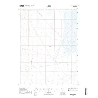
2020 Map of Hastings Pass SE
USGS Topo · Published 2020About this map
Skull Valley defines the arid character of this Tooele County landscape, where the historical footprint of western migration is still traced by modern thoroughfares. The presence of Hastings Cutoff Rd serves as a significant marker of the California Trail's legacy, traversing the valley floor as a testament to mid-19th-century overland travel routes. Water remains a critical element for any activity in this environment, represented here by the extensive marshy wetlands of Delle Springs to the east. The map detail highlights a network of local access ways, including Water Rd, Stock Rd, and Stock North Fork Rd, which reflect the region's enduring reliance on range management and livestock infrastructure within the open basin.
Find a feature on this map
7 named features on this map. Tap any name to fly to it.
Don’t see what you’re looking for? This feature index may not catch every label — zoom into the map to look around manually.
Map Details
Editions of this 2020 Hastings Pass SE Map
This is the sole edition of this map. No revisions or reprints were ever made.
Other maps of this area

1885 · Tooele Valley
USGS Topo · 1:250,000

1953 · Tooele
USGS Topo · 1:250,000

1955 · Tabbys Peak
USGS Topo · 1:24,000

1955 · Timpie
USGS Topo · 1:62,500

1955 · Deseret Peak
USGS Topo · 1:62,500

1955 · Tooele
USGS Topo · 1:250,000

1973 · Hastings Pass NE
USGS Topo · 1:24,000

1973 · Quincy Spring
USGS Topo · 1:24,000

1973 · Hastings Pass
USGS Topo · 1:24,000

1973 · Hickman Knolls
USGS Topo · 1:24,000