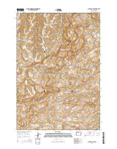
2014 Map of Hastings Peak
USGS Topo · Published 2014About this map
Hastings Peak and the high ridges of the central Oregon high desert define this high-elevation terrain in Wasco County. The map reveals a land sculpted by drainage systems such as Long Hollow Cr and Pole Cr, which cut through distinctive geological formations like Chinaman Hat and Black Rock. The presence of ephemeral or seasonal water features such as Tule Lake and Big Dry Lake underscores the arid character of the landscape, where water management and topography dictated early ranching and travel routes. Significant landmarks including North Pole Ridge and Maupin Butte provide orientation across the expansive plateaus of Jessie Flat and deep incisions like Cold Spring Canyon. Local transportation is anchored by Or-218, which winds through the southern portion of the quadrangle near Grub Hollow Cr.
Find a feature on this map
25 named features on this map. Tap any name to fly to it.
Don’t see what you’re looking for? This feature index may not catch every label — zoom into the map to look around manually.
Map Details
Editions of this 2014 Hastings Peak Map
This is the sole edition of this map. No revisions or reprints were ever made.
Other maps of this area

1916 · Condon
USGS Topo · 1:125,000

1926 · Mitchell
USGS Topo · 1:125,000

1953 · The Dalles
USGS Topo · 1:250,000

1955 · Bend
USGS Topo · 1:250,000

1956 · The Dalles
USGS Topo · 1:250,000

1957 · Bend
USGS Topo · 1:250,000

1957 · The Dalles
USGS Topo · 1:250,000

1958 · Bend
USGS Topo · 1:250,000

1966 · Antelope
USGS Topo · 1:62,500

1966 · Clarno
USGS Topo · 1:62,500