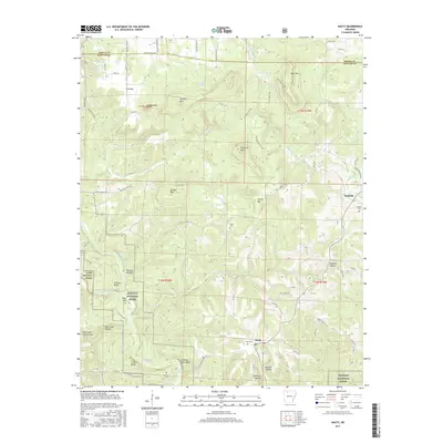
2017 Map of Hasty
USGS Topo · Published 2017About this map
Hasty sits at the heart of this landscape where the Buffalo River and Little Buffalo River converge. This area is characterized by dramatic topographic relief, defined by river bluffs and named summits like Fodderstack Mtn and Pinnacle Mtn. The river corridor, protected as the Buffalo National River, preserves a rugged stretch of the Ozarks where vertical landmarks such as Gray Bluff and Chimney Rock Bluff overlook the winding water.
Find a feature on this map
88 named features on this map. Tap any name to fly to it.
Don’t see what you’re looking for? This feature index may not catch every label — zoom into the map to look around manually.
Map Details
Editions of this 2017 Hasty Map
This is the sole edition of this map. No revisions or reprints were ever made.
Other maps of this area

1892 · Marshall
USGS Topo · 1:125,000

1893 · Yellville
USGS Topo · 1:125,000

1894 · Marshall
USGS Topo · 1:125,000

1901 · Marshall
USGS Topo · 1:125,000

1903 · Yellville
USGS Topo · 1:125,000

1904 · Harrison
USGS Topo · 1:125,000

1905 · Harrison
USGS Topo · 1:125,000

1905 · Yellville
USGS Topo · 1:125,000

1929 · Yellville
USGS Topo · 1:125,000

1933 · Mt Judea
USGS Topo · 1:62,500