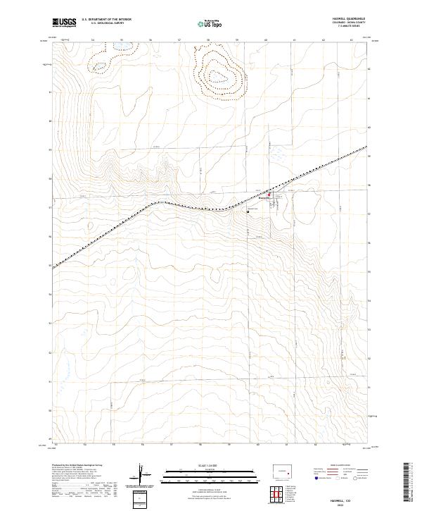
2022 Map of Haswell
USGS Topo · Published 2022About this map
The town of Haswell serves as the focal point of this Kiowa County survey, situated at the junction of several regional routes that intersect in the high plains. A rigid grid of section lines and gravel roads, including Co Rd P and Co Rd 19, defines the surrounding prairie landscape. The small settlement is concentrated along Main St and Spencer Ave, with residential blocks nestled near the central railroad corridor. Just south of the town center, the Haswell Cem provides a local genealogical record for the community. The land is characterized by numerous small depressions and intermittent water features, typical of the arid geography in this part of eastern Colorado. This layout reflects a classic Western settlement pattern where a single town center supports a sprawling network of nearby agricultural sections and range land.
Find a feature on this map
22 named features on this map. Tap any name to fly to it.
Don’t see what you’re looking for? This feature index may not catch every label — zoom into the map to look around manually.
Map Details
Editions of this 2022 Haswell Map
This is the sole edition of this map. No revisions or reprints were ever made.
Other maps of this area

1891 · Arroyo
USGS Topo · 1:125,000

1891 · Las Animas
USGS Topo · 1:125,000

1893 · Arroyo
USGS Topo · 1:125,000

1893 · Las Animas
USGS Topo · 1:125,000

1954 · Lamar
USGS Topo · 1:250,000

1958 · Lamar
USGS Topo · 1:250,000

1974 · Haswell
USGS Topo · 1:24,000
1974 · Haswell SE
USGS Topo · 1:24,000

1974 · Arlington NE
USGS Topo · 1:24,000
1978 · Long Lake
USGS Topo · 1:24,000