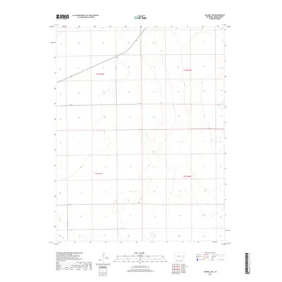
2019 Map of Haswell NE
USGS Topo · Published 2019About this map
Kiowa County's high plains terrain is defined by a sparse network of section-line roads and intermittent drainage patterns in this corner of Colorado. The landscape follows the Public Land Survey System, with the boundaries of t18s r51w, t18s r50w, t19s r51w, and t19s r50w providing the primary geographic structure. This area is characterized by low relief and seasonal wetlands, where the natural topography is punctuated only by local thoroughfares such as Co Rd 24 and Co Rd P. The rectilinear grid of Co Rd N, Co Rd K, and Co Rd 22 highlights the transition between open range and agricultural development typical of the eastern Colorado plains. The map provides a clear look at the drainage basins and contour elevations that govern water management in this arid environment.
Find a feature on this map
9 named features on this map. Tap any name to fly to it.
Don’t see what you’re looking for? This feature index may not catch every label — zoom into the map to look around manually.
Map Details
Editions of this 2019 Haswell NE Map
This is the sole edition of this map. No revisions or reprints were ever made.
Other maps of this area

1891 · Arroyo
USGS Topo · 1:125,000

1891 · Kit Carson
USGS Topo · 1:125,000

1891 · Las Animas
USGS Topo · 1:125,000

1892 · Lamar
USGS Topo · 1:125,000

1893 · Arroyo
USGS Topo · 1:125,000

1893 · Kit Carson
USGS Topo · 1:125,000

1893 · Las Animas
USGS Topo · 1:125,000

1954 · Lamar
USGS Topo · 1:250,000

1958 · Lamar
USGS Topo · 1:250,000

1968 · Rose Ranch
USGS Topo · 1:24,000