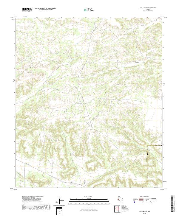
2022 Map of Hat-A Ranch
USGS Topo · Published 2022About this map
Lower Fourmile Draw and Harral Draw define the drainage patterns of this high-plateau landscape on the border of Pecos and Terrell counties. This modern survey illustrates the sparse infrastructure of the Trans-Pecos region, where transit is restricted to a few primary arteries like Ranch Rd 2886 and the unpaved Harral Rd. The terrain is characterized by a dense network of branching canyons and ridges typical of the Edwards Plateau's western margins, showing how ranching access is funneled through these natural draws. The political boundary between Pecos and Terrell is clearly delineated, crossing through the dissected topography in the southeastern portion of the map.
Find a feature on this map
5 named features on this map. Tap any name to fly to it.
Don’t see what you’re looking for? This feature index may not catch every label — zoom into the map to look around manually.
Map Details
Editions of this 2022 Hat-A Ranch Map
This is the sole edition of this map. No revisions or reprints were ever made.
Other maps of this area

1929 · Independence Draw Quadrangle
USGS Topo · 1:125,000

1954 · Fort Stockton
USGS Topo · 1:250,000

1958 · Fort Stockton
USGS Topo · 1:250,000
1969 · Smoky Mountain Ranch
USGS Topo · 1:24,000
1969 · Mitchell Draw
USGS Topo · 1:24,000
1969 · Seventeen Ranch
USGS Topo · 1:24,000

1969 · Hackberry Draw NE
USGS Topo · 1:24,000
1969 · Hackberry Draw SE
USGS Topo · 1:24,000
1969 · Hat-A Ranch
USGS Topo · 1:24,000
1969 · Indian Mesa SE
USGS Topo · 1:24,000