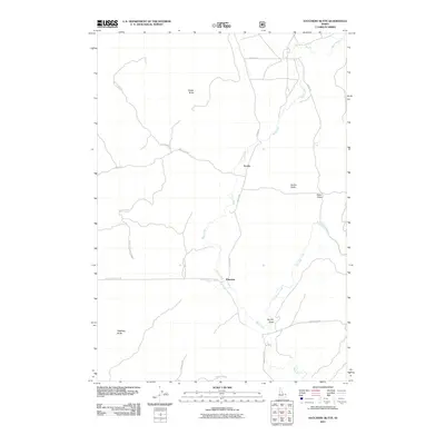
2011 Map of Hatchery Butte
USGS Topo · Published 2011About this map
Eccles and Pineview anchor this upland landscape in Fremont County, where the terrain is defined by a series of prominent rises and drainage draws. The Warm River winds through the central portion of the map, carving a path between Ripley Butte and Eccles Butte. This 2011 survey reveals a network of forest and access roads, such as Eccles Rd and N Hatchery Butte Rd, that navigate the high country around Hatchery Butte. The presence of features like Black Spring and various seasonal drainages like Partridge Creek indicate a landscape shaped by water flow across the volcanic or high-plateau geography of eastern Idaho. Small settlements and local landmarks like Survey Draw provide specific points of reference for those researching the land use and topographic character of the region during the early 21st century.
Find a feature on this map
21 named features on this map. Tap any name to fly to it.
Don’t see what you’re looking for? This feature index may not catch every label — zoom into the map to look around manually.
Map Details
Editions of this 2011 Hatchery Butte Map
This is the sole edition of this map. No revisions or reprints were ever made.
Other maps of this area

1955 · Ashton
USGS Topo · 1:250,000

1957 · Warm River Butte
USGS Topo · 1:62,500

1957 · Buffalo Lake
USGS Topo · 1:62,500

1958 · Ashton
USGS Topo · 1:250,000

1960 · Ashton
USGS Topo · 1:250,000

1964 · Hatchery Butte
USGS Topo · 1:24,000

1964 · Island Park
USGS Topo · 1:24,000

1964 · Island Park Dam
USGS Topo · 1:24,000

1964 · Last Chance
USGS Topo · 1:24,000

1965 · Lookout Butte
USGS Topo · 1:24,000