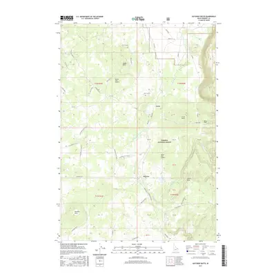
2017 Map of Hatchery Butte
USGS Topo · Published 2017About this map
Henrys Fork Caldera and Island Park Caldera define the unique volcanic geography of this section of the Targhee National Forest. The landscape is shaped by distinct volcanic features and high-altitude drainage systems, most notably Warm River and its tributaries like Partridge Cr. Small settlements such as Eccles and Pineview are situated among a complex network of forest access roads, including Eccles Rd and various spurs leading to prominent high points like Hatchery Butte and Ripley Butte. The land is further marked by several named draws and canyons, such as Baker Draw and Flat Canyon, illustrating the varied terrain within the caldera systems. This 2017 survey details the infrastructure of the forest and its seasonal water features, including Lily Pond and Black Spring, during a period of modern forest management and recreation.
Find a feature on this map
53 named features on this map. Tap any name to fly to it.
Don’t see what you’re looking for? This feature index may not catch every label — zoom into the map to look around manually.
Map Details
Editions of this 2017 Hatchery Butte Map
This is the sole edition of this map. No revisions or reprints were ever made.
Other maps of this area

1955 · Ashton
USGS Topo · 1:250,000

1957 · Warm River Butte
USGS Topo · 1:62,500

1957 · Buffalo Lake
USGS Topo · 1:62,500

1958 · Ashton
USGS Topo · 1:250,000

1960 · Ashton
USGS Topo · 1:250,000

1964 · Hatchery Butte
USGS Topo · 1:24,000

1964 · Island Park
USGS Topo · 1:24,000

1964 · Island Park Dam
USGS Topo · 1:24,000

1964 · Last Chance
USGS Topo · 1:24,000

1965 · Lookout Butte
USGS Topo · 1:24,000