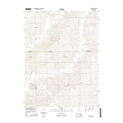
2014 Map of Hatfield
USGS Topo · Published 2014About this map
Hatfield stands as the primary settlement in this rural landscape straddling the Harrison County line, where the drainage systems of the E Fork Grand River and Lotts Cr carve through the north-central Missouri borderlands. The map reveals a high density of small, community-linked burial grounds including Lincoln Center Cemetery, Caledonia Cemetery, and Petry Cemetery, often located near crossroads or along section lines. This pattern of land use reflects the enduring rural character of the region, where tiny unincorporated hamlets like Watterson are connected by a grid of local roads and county lines. Hydrological features such as Marie Lake and the branching of the W Fork Big Muddy Cr provide a detailed look at the local watershed before it flows south into the Missouri interior.
Find a feature on this map
62 named features on this map. Tap any name to fly to it.
Don’t see what you’re looking for? This feature index may not catch every label — zoom into the map to look around manually.
Map Details
Editions of this 2014 Hatfield Map
This is the sole edition of this map. No revisions or reprints were ever made.
Other maps of this area

1940 · Blockton
USGS Topo · 1:62,500

1942 · Grant City
USGS Topo · 1:62,500

1943 · Grant City
USGS Topo · 1:62,500

1943 · Blockton
USGS Topo · 1:62,500

1945 · Mount Ayr
USGS Topo · 1:62,500

1947 · Mount Ayr
USGS Topo · 1:62,500

1948 · Bethany
USGS Topo · 1:62,500

1955 · Nebraska City
USGS Topo · 1:250,000

1957 · Nebraska City
USGS Topo · 1:250,000

1958 · Nebraska City
USGS Topo · 1:250,000