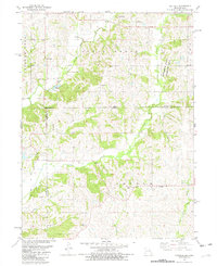
1981 Map of Hatfield
USGS Topo · Published 1982About this map
Hatfield and the surrounding rural townships of Lincoln and Smith occupy this 1981 survey along the Missouri-Iowa border. The landscape is defined by the headwaters of the Grand River and the Lotts Creek drainage, where the terrain transitions between Harrison County and Ringgold County. Notable for its high density of family and community burial grounds, the area includes the Caledonia Cem, Oakdale Cem, and Petty Cem, reflecting a long-established settlement pattern of small farmsteads and rural crossroads. Local landmarks like Lotts Grove Ch and the neighboring Lotts Grove Cem anchor the community history, while the Ringgold State Wildlife Area and a nearby Quarry represent the contemporary land use of the late twentieth century. Small hamlets such as Watterson, Caledonia, and Ringgold appear as quiet rural hubs connected by a network of unimproved roads and a solitary Landing Strip.
Find a feature on this map
31 named features on this map. Tap any name to fly to it.
Don’t see what you’re looking for? This feature index may not catch every label — zoom into the map to look around manually.
Map Details
Editions of this 1981 Hatfield Map
This is the sole edition of this map. No revisions or reprints were ever made.
Other maps of this area

1940 · Blockton
USGS Topo · 1:62,500

1942 · Grant City
USGS Topo · 1:62,500

1943 · Grant City
USGS Topo · 1:62,500

1943 · Blockton
USGS Topo · 1:62,500

1945 · Mount Ayr
USGS Topo · 1:62,500

1947 · Mount Ayr
USGS Topo · 1:62,500

1948 · Bethany
USGS Topo · 1:62,500

1955 · Nebraska City
USGS Topo · 1:250,000

1957 · Nebraska City
USGS Topo · 1:250,000

1958 · Nebraska City
USGS Topo · 1:250,000