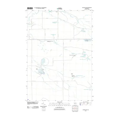
2010 Map of Hatfield SW
USGS Topo · Published 2010About this map
The Jackson County Iron Mine and its distinct excavation site near Iron Mound define the industrial footprint of this central Wisconsin landscape. The terrain is characterized by a sophisticated network of water management features, including numerous flowages and dams credited to the Resettlement Administration, such as the Resettlement Administration 21 Dam and Resettlement Administration 8 Dam. These structures transformed the drainage of Dickey Creek and Levis Creek into reservoirs like Teal Flowage 7, Big Bear Flowage, and Squaw Mound Flowage 4. Cultural landmarks are centered around the Komensky Cemetery in the north and the prominent elevation of Squaw Mound to the south. The map details a rural grid of roads, including Funmaker Rd and S Cemetery Rd, which connect these managed water bodies and isolated industrial sites.
Find a feature on this map
49 named features on this map. Tap any name to fly to it.
Don’t see what you’re looking for? This feature index may not catch every label — zoom into the map to look around manually.
Map Details
Editions of this 2010 Hatfield SW Map
This is the sole edition of this map. No revisions or reprints were ever made.
Other maps of this area

1924 · Black River Falls
USGS Topo · 1:62,500

1926 · Black River Falls
USGS Topo · 1:62,500

1928 · Melrose
USGS Topo · 1:48,000

1947 · Millston
USGS Topo · 1:62,500

1949 · Millston
USGS Topo · 1:62,500

1949 · Melrose
USGS Topo · 1:62,500

1953 · Eau Claire
USGS Topo · 1:250,000

1958 · Eau Claire
USGS Topo · 1:250,000

1958 · Hatfield
USGS Topo · 1:48,000

1964 · Eau Claire
USGS Topo · 1:250,000