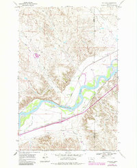
1968 Map of Hathaway
USGS Topo · Published 1985About this map
The Yellowstone River cuts a wide, braided path through this eastern Montana landscape, defining the local geography as it flows past the small settlements of Hathaway and Sheffield. This late-1960s survey documents a region where transportation and water are the primary anchors of human activity, with the tracks of the Burlington Northern railroad running parallel to the river valley. The map reveals a dissected terrain where numerous drainages, including Iron Jaw Creek, Graveyard Creek, and Sweeny Creek, carve through the uplands to reach the river bottom.
Find a feature on this map
15 named features on this map. Tap any name to fly to it.
Don’t see what you’re looking for? This feature index may not catch every label — zoom into the map to look around manually.
Map Details
Editions of this 1968 Hathaway Map
2 editions found
Other maps of this area

1954 · Forsyth
USGS Topo · 1:250,000

1957 · Forsyth
USGS Topo · 1:250,000

1958 · Forsyth
USGS Topo · 1:250,000

1968 · Sand Buttes
USGS Topo · 1:24,000

1968 · Hathaway
USGS Topo · 1:24,000

1968 · Butterfly Creek
USGS Topo · 1:24,000

1968 · Horton
USGS Topo · 1:24,000

1968 · Hathaway NW
USGS Topo · 1:24,000

1968 · Thurlow
USGS Topo · 1:24,000
1969 · Moon Creek School
USGS Topo · 1:24,000