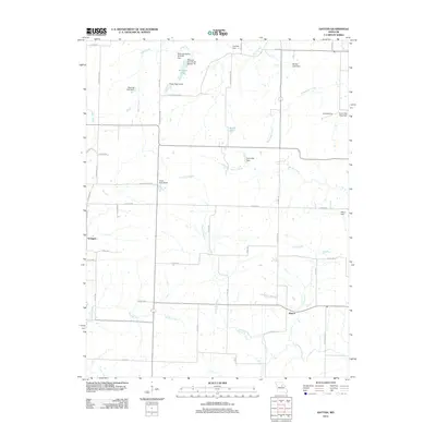
2012 Map of Hatton
USGS Topo · Published 2012About this map
Hatton and the nearby community of Youngers anchor this northern Callaway County landscape, where the headwaters of numerous creeks converge. The terrain is defined by a dense network of small agricultural impoundments, including family-named sites like Bastian Lake Dam, Bruns Lake, and Williams Lake. These water features feed into larger drainage systems such as Beaverdam Creek and Fourmile Branch, which eventually reach Auxvasse Creek to the south. The road network, largely comprised of county routes like Co RD 2000 and State Road M, reflects the rural development patterns of the early 21st century. An isolated Landing Strip near the Audrain County line highlights the region's reliance on localized transportation and infrastructure within the agricultural heartland of Missouri.
Find a feature on this map
51 named features on this map. Tap any name to fly to it.
Don’t see what you’re looking for? This feature index may not catch every label — zoom into the map to look around manually.
Map Details
Editions of this 2012 Hatton Map
This is the sole edition of this map. No revisions or reprints were ever made.
Other maps of this area

1886 · Jefferson City
USGS Topo · 1:125,000

1890 · Mexico
USGS Topo · 1:125,000

1890 · Moberly
USGS Topo · 1:125,000

1890 · Fulton
USGS Topo · 1:125,000

1894 · Jefferson City
USGS Topo · 1:125,000

1928 · Fulton
USGS Topo · 1:62,500

1931 · Fulton
USGS Topo · 1:62,500

1932 · Mexico
USGS Topo · 1:62,500

1944 · Millersburg
USGS Topo · 1:62,500

1945 · Centralia
USGS Topo · 1:62,500