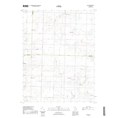
2017 Map of Hatton
USGS Topo · Published 2017About this map
The unincorporated community of Hatton sits in the southeastern portion of this landscape, near the confluence of local tributaries that feed into the larger Auxvasse Cr. This central Missouri region is defined by its complex drainage network, including Fourmile Br, Renfro Cr, and Bynum Cr, which carve through the terrain between the small settlements of Youngers and Hatton. Genealogists will find the Youngers Cem located near the Boone and Callaway county line, a significant marker of local family history and early burial sites.
Find a feature on this map
59 named features on this map. Tap any name to fly to it.
Don’t see what you’re looking for? This feature index may not catch every label — zoom into the map to look around manually.
Map Details
Editions of this 2017 Hatton Map
This is the sole edition of this map. No revisions or reprints were ever made.
Other maps of this area

1886 · Jefferson City
USGS Topo · 1:125,000

1890 · Mexico
USGS Topo · 1:125,000

1890 · Moberly
USGS Topo · 1:125,000

1890 · Fulton
USGS Topo · 1:125,000

1894 · Jefferson City
USGS Topo · 1:125,000

1928 · Fulton
USGS Topo · 1:62,500

1931 · Fulton
USGS Topo · 1:62,500

1932 · Mexico
USGS Topo · 1:62,500

1944 · Millersburg
USGS Topo · 1:62,500

1945 · Centralia
USGS Topo · 1:62,500