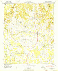
1951 Map of Hatton
USGS Topo · Published 1951About this map
The Moulton Valley defines the lower half of this landscape, where the agricultural community of Hatton sits at a central road junction. This late-1940s survey reveals a dense network of country churches and family burial grounds, such as Sanderson Chapel, Harris Chapel, and the Fergason Cem, indicating a well-established rural social structure. To the north, the terrain rises sharply toward Black Ground Mountain and the prominent heights of Pilot Knob and Black Wax Hill.
Find a feature on this map
61 named features on this map. Tap any name to fly to it.
Don’t see what you’re looking for? This feature index may not catch every label — zoom into the map to look around manually.
Map Details
Editions of this 1951 Hatton Map
2 editions found
Other maps of this area

1924 · Tuscumbia
USGS Topo · 1:48,000

1926 · Tuscumbia
USGS Topo · 1:62,500

1935 · Moulton
USGS Topo · 1:24,000

1936 · Newburg
USGS Topo · 1:24,000

1936 · Courtland
USGS Topo · 1:24,000

1936 · Moulton
USGS Topo · 1:48,000

1936 · Town Creek
USGS Topo · 1:24,000
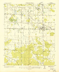
1936 · Leighton
USGS Topo · 1:24,000

1936 · Masterson
USGS Topo · 1:24,000

1936 · Hatton
USGS Topo · 1:24,000