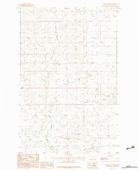
1983 Map of Hauck Coulee
USGS Topo · Published 1983About this map
Little Porcupine Creek and its complex network of drainage ravines dominate this 1983 topographic study of Valley County. This landscape, located within the Fort Peck Indian Reservation, is defined by the repetitive erosion patterns of coulees that feed into the larger creek system. Named features like Hauck Coulee, Jack Norris Coulee, and Neufeld Coulee suggest a history of ranching or homesteading, where early settlers relied on these intermittent water sources and the shelter of the terrain. The presence of an Airstrip in such a sparse environment highlights the region's reliance on aerial transportation for connectivity across the great distances of the Montana plains. Far from any significant towns, the map details the subtle contours of the Missouri River watershed, including smaller drainages like Tomato Can Creek and Johnson Coulee.
Find a feature on this map
11 named features on this map. Tap any name to fly to it.
Don’t see what you’re looking for? This feature index may not catch every label — zoom into the map to look around manually.
Map Details
Editions of this 1983 Hauck Coulee Map
This is the sole edition of this map. No revisions or reprints were ever made.
Other maps of this area

1910 · Todd Lakes
USGS Topo · 1:62,500

1915 · Frazer
USGS Topo · 1:62,500

1915 · Oswego
USGS Topo · 1:62,500

1915 · Todd Lakes
USGS Topo · 1:62,500

1915 · Spring Creek
USGS Topo · 1:62,500

1954 · Wolf Point
USGS Topo · 1:250,000

1954 · Glasgow
USGS Topo · 1:250,000

1957 · Glasgow
USGS Topo · 1:250,000

1958 · Wolf Point
USGS Topo · 1:250,000

1958 · Glasgow
USGS Topo · 1:250,000