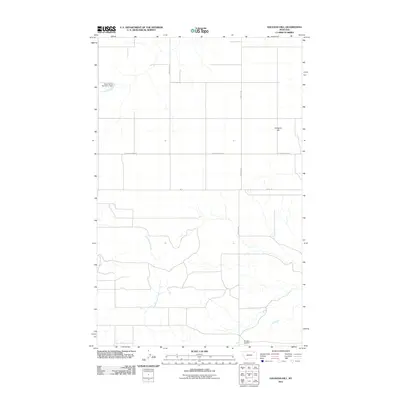
2011 Map of Haugens Hill
USGS Topo · Published 2011About this map
Haugens Hill anchors this northeast Montana landscape, a high point amidst a network of rural roads and seasonal watercourses. The 2011 survey illustrates a sparse ranching and agricultural environment where critical infrastructure is localized, such as the Miner Farms Number 1 Dam in the northwest. In the south, the Saubak Airport sits near the drainage of Cottonwood Creek, providing a focal point for the region's transport and utility. The map's grid is defined by arterial routes like Hellcreek Rd and Peerless Rd, which connect isolated homesteads and farms. This layout reflects the early 21st-century character of Valley County, where the topography dictates the placement of private reservoirs and small-scale aviation facilities in a wide-open terrain.
Find a feature on this map
9 named features on this map. Tap any name to fly to it.
Don’t see what you’re looking for? This feature index may not catch every label — zoom into the map to look around manually.
Map Details
Editions of this 2011 Haugens Hill Map
This is the sole edition of this map. No revisions or reprints were ever made.
Other maps of this area

1910 · Todd Lakes
USGS Topo · 1:62,500

1915 · Todd Lakes
USGS Topo · 1:62,500

1915 · Spring Creek
USGS Topo · 1:62,500

1954 · Wolf Point
USGS Topo · 1:250,000

1954 · Glasgow
USGS Topo · 1:250,000

1957 · Glasgow
USGS Topo · 1:250,000

1958 · Wolf Point
USGS Topo · 1:250,000

1958 · Glasgow
USGS Topo · 1:250,000

1973 · West Fork NE
USGS Topo · 1:24,000

1973 · Johnnys Hill
USGS Topo · 1:24,000