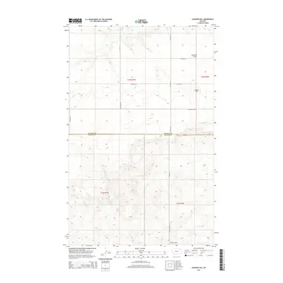
2014 Map of Haugens Hill
USGS Topo · Published 2014About this map
Haugens Hill rises above a landscape defined by expansive ranch lands and remote agricultural transit routes in this northern Montana survey. The terrain is marked by significant natural drainages such as Cottonwood Creek and Shipstead Coulee, which dictate the placement of local infrastructure. A network of rural section roads, including Hell Creek Rd and Peerless Rd, connects isolated properties and reflects the organized land division of Valley and Daniels counties. This 2014 representation captures the area's modern spatial arrangement, where private aviation at the Saubak Airport provides a crucial link for residents in a region where distances between major settlements are vast. The survey documents the enduring pastoral character of the territory along the Daniels-Valley County line, preserving the names of local family roads like Pankratz Rd and Kegel Rd.
Find a feature on this map
18 named features on this map. Tap any name to fly to it.
Don’t see what you’re looking for? This feature index may not catch every label — zoom into the map to look around manually.
Map Details
Editions of this 2014 Haugens Hill Map
This is the sole edition of this map. No revisions or reprints were ever made.
Other maps of this area

1910 · Todd Lakes
USGS Topo · 1:62,500

1915 · Todd Lakes
USGS Topo · 1:62,500

1915 · Spring Creek
USGS Topo · 1:62,500

1954 · Wolf Point
USGS Topo · 1:250,000

1954 · Glasgow
USGS Topo · 1:250,000

1957 · Glasgow
USGS Topo · 1:250,000

1958 · Wolf Point
USGS Topo · 1:250,000

1958 · Glasgow
USGS Topo · 1:250,000

1973 · West Fork NE
USGS Topo · 1:24,000

1973 · Johnnys Hill
USGS Topo · 1:24,000