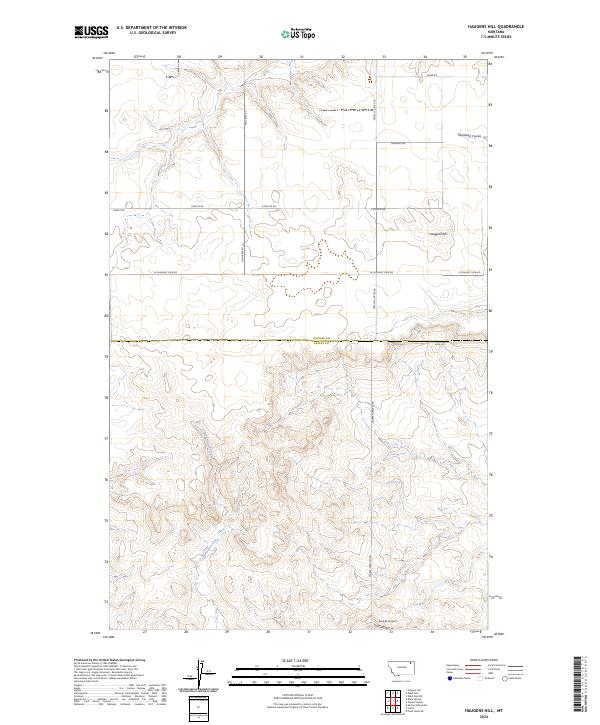
2024 Map of Haugens Hill
USGS Topo · Published 2024About this map
Haugens Hill stands as a prominent landmark on this high-plains landscape where Daniels Co and Valley Co meet. The terrain is defined by the drainage patterns of Shipstead Coulee in the north and the winding path of Cottonwood Creek to the south. This 2024 survey reflects a modern view of the region, emphasizing the sparse network of rural roads such as Peerless Lustre Rd and W Pleasant View Rd that connect the large, geometric sections of the Public Land Survey System. In the southern portion of the map, the inclusion of Saubak Airport indicates the ongoing importance of local aviation for land management and transportation in this expansive part of Montana.
Find a feature on this map
2 named features on this map. Tap any name to fly to it.
Don’t see what you’re looking for? This feature index may not catch every label — zoom into the map to look around manually.
Map Details
Editions of this 2024 Haugens Hill Map
This is the sole edition of this map. No revisions or reprints were ever made.
Other maps of this area

1910 · Todd Lakes
USGS Topo · 1:62,500

1915 · Todd Lakes
USGS Topo · 1:62,500

1915 · Spring Creek
USGS Topo · 1:62,500

1954 · Wolf Point
USGS Topo · 1:250,000

1954 · Glasgow
USGS Topo · 1:250,000

1957 · Glasgow
USGS Topo · 1:250,000

1958 · Wolf Point
USGS Topo · 1:250,000

1958 · Glasgow
USGS Topo · 1:250,000

1973 · West Fork NE
USGS Topo · 1:24,000

1973 · Johnnys Hill
USGS Topo · 1:24,000