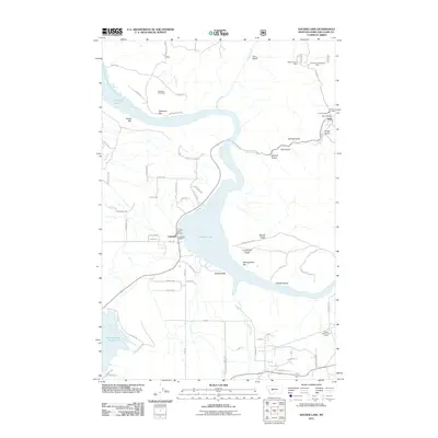
2011 Map of Hauser Lake
USGS Topo · Published 2011About this map
Hauser Lake serves as the central focal point of this region, winding through a landscape defined by industrial history and small-scale lakeside development. The settlement of York sits near the eastern edge, supported by the York Vol Fire Dept and neighboring York Cemetery. This area reflects a long-standing relationship with the land, evidenced by several extractive sites including the Eldorado Strip Mine and the Golden Charm Mine further north near Nelson Rd.
Find a feature on this map
67 named features on this map. Tap any name to fly to it.
Don’t see what you’re looking for? This feature index may not catch every label — zoom into the map to look around manually.
Map Details
Editions of this 2011 Hauser Lake Map
This is the sole edition of this map. No revisions or reprints were ever made.
Other maps of this area

1886 · Fort Logan
USGS Topo · 1:250,000

1899 · Helena
USGS Topo · 1:62,500

1948 · White Sulphur Springs
USGS Topo · 1:250,000

1950 · Canyon Ferry
USGS Topo · 1:62,500

1950 · East Helena
USGS Topo · 1:62,500

1958 · White Sulphur Springs
USGS Topo · 1:250,000

1961 · White Sulphur Springs
USGS Topo · 1:250,000
1962 · Upper Holter Lake
USGS Topo · 1:24,000

1962 · Hogback Mountain
USGS Topo · 1:24,000
1962 · Nelson
USGS Topo · 1:24,000