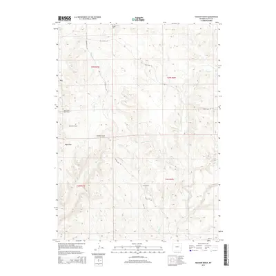
2015 Map of Haushar Ranch
USGS Topo · Published 2015About this map
Haushar Ranch and Herman Ranch occupy a landscape of complex drainage systems and ridges in this portion of Platte County. The terrain is defined by dramatic elevation changes, ranging from the heights of Sheep Mtn and Baldy to the deep cuts of Sawmill Canyon and Webb Cyn. This area reflects a classic Western ranching layout, where homesteads are positioned near seasonal water sources like Boxelder Cr and Spring Cr. Local movement is facilitated by specialized routes including Emigrant Hill Rd and Patten Creek Rd, which navigate the various draws and canyons. The prevalence of named geographic features like Buckshot Draw and Ragan Draw highlights how specific topographical landmarks served as vital reference points for land management and navigation in this rural environment.
Find a feature on this map
21 named features on this map. Tap any name to fly to it.
Don’t see what you’re looking for? This feature index may not catch every label — zoom into the map to look around manually.
Map Details
Editions of this 2015 Haushar Ranch Map
This is the sole edition of this map. No revisions or reprints were ever made.
Other maps of this area

1896 · Hartville
USGS Topo · 1:125,000

1901 · Hartville
USGS Topo · 1:125,000

1949 · Cedar Top
USGS Topo · 1:24,000

1950 · Cedar Top
USGS Topo · 1:24,000

1950 · Jewel Springs
USGS Topo · 1:24,000

1950 · Guernsey
USGS Topo · 1:24,000

1950 · Herman Ranch
USGS Topo · 1:24,000

1950 · Haushar Ranch
USGS Topo · 1:24,000

1950 · Hell Gap
USGS Topo · 1:24,000

1950 · Guernsey Reservoir
USGS Topo · 1:24,000