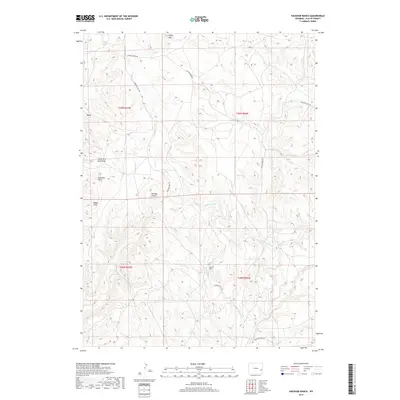
2017 Map of Haushar Ranch
USGS Topo · Published 2017About this map
Haushar Ranch sits at the heart of this high-plains landscape in Platte County, where the terrain is defined by a series of named draws and canyons. The presence of Sawmill Canyon and Buckshot Draw suggests a history of localized natural resource use and rugged frontier navigation. The elevation rises toward the northern boundary at Sheep Mtn and Baldy, while the drainage system of Patten Creek and its many tributaries, such as Boxelder Cr and Spring Cr, dictates the movement across the land. Historical travel routes are preserved through the alignments of Emigrant Hill Rd and Patten Creek Rd, which follow the contours of the drainage basins. This area is characterized by the Dearcorn Draw and South Fork Sand Draw, reflecting a classic Wyoming ranching environment where water sources and topography determined the location of early outposts.
Find a feature on this map
20 named features on this map. Tap any name to fly to it.
Don’t see what you’re looking for? This feature index may not catch every label — zoom into the map to look around manually.
Map Details
Editions of this 2017 Haushar Ranch Map
This is the sole edition of this map. No revisions or reprints were ever made.
Other maps of this area

1896 · Hartville
USGS Topo · 1:125,000

1901 · Hartville
USGS Topo · 1:125,000

1949 · Cedar Top
USGS Topo · 1:24,000

1950 · Cedar Top
USGS Topo · 1:24,000

1950 · Jewel Springs
USGS Topo · 1:24,000

1950 · Guernsey
USGS Topo · 1:24,000

1950 · Herman Ranch
USGS Topo · 1:24,000

1950 · Haushar Ranch
USGS Topo · 1:24,000

1950 · Hell Gap
USGS Topo · 1:24,000

1950 · Guernsey Reservoir
USGS Topo · 1:24,000