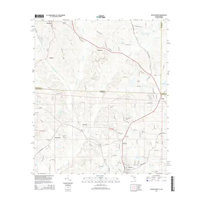
2015 Map of Havana North
USGS Topo · Published 2015About this map
Havana and its surrounding rural landscapes are captured here along the Florida-Georgia state line during the mid-2010s. This agricultural corridor, characterized by the drainage of Attapulgus Cr and Little Attapulgus Cr, features a high density of named family cemeteries and small rural settlements. Historically significant locations like Amsterdam and Jamieson are documented alongside specialized local infrastructure, including the Peavy Farms Airport and Saranac Farm Airport. The topography is defined by features such as White Oak Ridge, while the local economy is reflected in the numerous ponds and small lakes like Cecil Butler Lake and Dubarco S Lake. Genealogists will find notable value in the precisely located burial grounds, such as Griffin Cem, Hopkins Cem, and Mount Zion Cem, which anchor the small communities throughout Gadsden and Decatur counties.
Find a feature on this map
107 named features on this map. Tap any name to fly to it.
Don’t see what you’re looking for? This feature index may not catch every label — zoom into the map to look around manually.
Map Details
Editions of this 2015 Havana North Map
This is the sole edition of this map. No revisions or reprints were ever made.
Other maps of this area

1954 · Tallahassee
USGS Topo · 1:250,000

1955 · Bainbridge
USGS Topo · 1:62,500

1955 · Whigham
USGS Topo · 1:62,500

1956 · Havana North
USGS Topo · 1:24,000

1956 · Dogtown
USGS Topo · 1:24,000

1956 · Calvary
USGS Topo · 1:24,000

1959 · Tallahassee
USGS Topo · 1:250,000

1959 · Quincy
USGS Topo · 1:24,000

1960 · Tallahassee
USGS Topo · 1:250,000

1963 · Lake Jackson
USGS Topo · 1:24,000