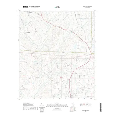
2021 Map of Havana North
USGS Topo · Published 2021About this map
Attapulgus and Amsterdam anchor the northern reaches of this borderlands survey, situated along the dividing line between Decatur County, Georgia, and Gadsden County, Florida. This tobacco-growing region is defined by a landscape of small agricultural settlements and family-named landmarks like Griffin Cem and Darsey Cem. The area shows a transition from the rolling terrain near Little Attapulgus Cr toward the southern community of Havana.
Find a feature on this map
114 named features on this map. Tap any name to fly to it.
Don’t see what you’re looking for? This feature index may not catch every label — zoom into the map to look around manually.
Map Details
Editions of this 2021 Havana North Map
This is the sole edition of this map. No revisions or reprints were ever made.
Other maps of this area

1954 · Tallahassee
USGS Topo · 1:250,000

1955 · Bainbridge
USGS Topo · 1:62,500

1955 · Whigham
USGS Topo · 1:62,500

1956 · Havana North
USGS Topo · 1:24,000

1956 · Dogtown
USGS Topo · 1:24,000

1956 · Calvary
USGS Topo · 1:24,000

1959 · Tallahassee
USGS Topo · 1:250,000

1959 · Quincy
USGS Topo · 1:24,000

1960 · Tallahassee
USGS Topo · 1:250,000

1963 · Lake Jackson
USGS Topo · 1:24,000