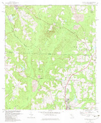
1982 Map of Havana North
USGS Topo · Published 1983About this map
The Georgia Florida state line bisects this landscape, separating the tobacco-growing and clay-mining country of Gadsden County from the rural reaches of Decatur and Grady Counties. Industrial patterns are etched into the terrain via numerous Strip Mines, claypits, and the Industrial Waste Ponds near Attapulgus. These excavations contrast with the steady flow of Attapulgus Creek and the marshy expanses of the Swamp.
Find a feature on this map
46 named features on this map. Tap any name to fly to it.
Don’t see what you’re looking for? This feature index may not catch every label — zoom into the map to look around manually.
Map Details
Editions of this 1982 Havana North Map
This is the sole edition of this map. No revisions or reprints were ever made.
Other maps of this area

1954 · Tallahassee
USGS Topo · 1:250,000

1955 · Bainbridge
USGS Topo · 1:62,500

1955 · Whigham
USGS Topo · 1:62,500

1956 · Havana North
USGS Topo · 1:24,000

1956 · Dogtown
USGS Topo · 1:24,000

1956 · Calvary
USGS Topo · 1:24,000

1959 · Tallahassee
USGS Topo · 1:250,000

1959 · Quincy
USGS Topo · 1:24,000

1960 · Tallahassee
USGS Topo · 1:250,000

1963 · Lake Jackson
USGS Topo · 1:24,000