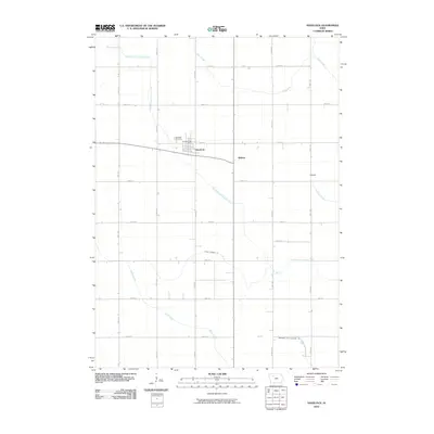
2010 Map of Havelock
USGS Topo · Published 2010About this map
Havelock sits as the primary settlement in this corner of Pocahontas County, defined by its traditional Midwestern grid and the essential services of the Havelock Post Office and the Havelock Cemetery. The surrounding landscape is dominated by a meticulously engineered drainage system, reflecting the area's agricultural history. Natural waterways like North Branch Lizard Creek, Pilot Creek, and Crooked Creek are supplemented by man-made channels including Ditch Number 112 and Drainage Ditch Number 169, which redirect water through the flat terrain. Minor rail-side or crossroads points such as Ridotto and Rubens provide evidence of earlier regional transit and gathering spots that shaped the local community. The map illustrates a landscape where the natural flow of Lizard Creek has been carefully managed to support the sprawling farmsteads connected by a precise network of numbered roads like 450th St and 210th Ave.
Find a feature on this map
25 named features on this map. Tap any name to fly to it.
Don’t see what you’re looking for? This feature index may not catch every label — zoom into the map to look around manually.
Map Details
Editions of this 2010 Havelock Map
This is the sole edition of this map. No revisions or reprints were ever made.
Other maps of this area

1954 · Fort Dodge
USGS Topo · 1:250,000

1957 · Fort Dodge
USGS Topo · 1:250,000

1958 · Fort Dodge
USGS Topo · 1:250,000

1971 · Rush Lake East
USGS Topo · 1:24,000

1971 · Laurens
USGS Topo · 1:24,000

1979 · Pocahontas
USGS Topo · 1:24,000

1979 · Palmer
USGS Topo · 1:24,000

1979 · Fonda NE
USGS Topo · 1:24,000

1980 · Rolfe
USGS Topo · 1:24,000

1980 · Havelock
USGS Topo · 1:24,000