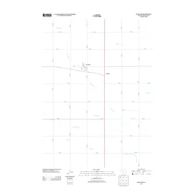
2013 Map of Havelock
USGS Topo · Published 2013About this map
Havelock sits at the heart of this agricultural survey in Pocahontas County, defined by a grid of rural roads and an extensive network of waterways and drainage systems. The town layout is clearly visible with streets such as Main St, Cass St, and Clay St providing a detailed view of the community's footprint in the early 21st century. Surrounding the settlement, the landscape is shaped by the winding courses of N Br Lizard Cr and Lizard Cr, supplemented by man-made infrastructure like Ditch Number 112 and Drainage Ditch Number 169. These features reflect the intensive management of the prairie soil for cultivation. Smaller named locales such as Ridotto and Rubens mark distinct points along the thoroughfares, while Pilot Cr and Crooked Cr drain the outlying sections of this quintessential Iowa farming region.
Find a feature on this map
30 named features on this map. Tap any name to fly to it.
Don’t see what you’re looking for? This feature index may not catch every label — zoom into the map to look around manually.
Map Details
Editions of this 2013 Havelock Map
This is the sole edition of this map. No revisions or reprints were ever made.
Other maps of this area

1954 · Fort Dodge
USGS Topo · 1:250,000

1957 · Fort Dodge
USGS Topo · 1:250,000

1958 · Fort Dodge
USGS Topo · 1:250,000

1971 · Rush Lake East
USGS Topo · 1:24,000

1971 · Laurens
USGS Topo · 1:24,000

1979 · Pocahontas
USGS Topo · 1:24,000

1979 · Palmer
USGS Topo · 1:24,000

1979 · Fonda NE
USGS Topo · 1:24,000

1980 · Rolfe
USGS Topo · 1:24,000

1980 · Havelock
USGS Topo · 1:24,000