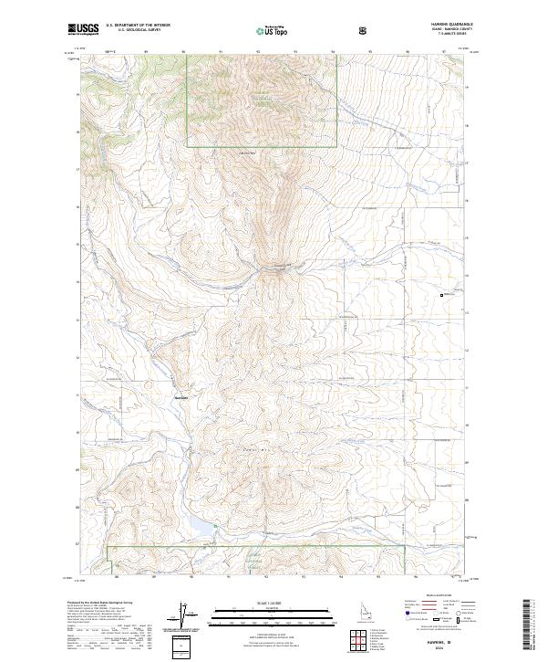
2024 Map of Hawkins
USGS Topo · Published 2024About this map
Hawkins anchors the western portion of this landscape, situated along the drainage of Hawkins Creek in the high country of Bannock County. The terrain is defined by the significant elevations of Old Tom Mtn to the north and Cedar Mtn toward the south, with the Caribou National Forest encompassing the northern and southern edges of the quadrangle. A network of rural routes, including S Hawkins Rd and Harrington Rd, connects the scattered dwellings and ranching lands that characterize this part of Idaho.
Find a feature on this map
49 named features on this map. Tap any name to fly to it.
Don’t see what you’re looking for? This feature index may not catch every label — zoom into the map to look around manually.
Map Details
Editions of this 2024 Hawkins Map
This is the sole edition of this map. No revisions or reprints were ever made.
Other maps of this area

1954 · Pocatello
USGS Topo · 1:250,000

1958 · Pocatello
USGS Topo · 1:250,000

1968 · Dairy Creek
USGS Topo · 1:24,000

1968 · Downey West
USGS Topo · 1:24,000

1968 · Wakley Peak
USGS Topo · 1:24,000

1968 · Hawkins
USGS Topo · 1:24,000

1968 · Clifton Creek
USGS Topo · 1:24,000
1968 · Arimo
USGS Topo · 1:24,000

1968 · Bradley Mtn
USGS Topo · 1:24,000

1968 · Mc Cammon
USGS Topo · 1:24,000