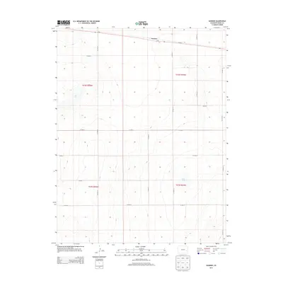
2013 Map of Hawkins
USGS Topo · Published 2013About this map
Hawkins sits along the northern edge of this high plains landscape, positioned directly on the east-west route of Co-96. The surrounding terrain is defined by a grid of rural tracks including Co Road 30 and Co Road N, which partition the open prairie into the Public Land Survey System sections of t018s r050w and t019s r049w. Notable depressions in the landscape are marked by Salt Lake in the northwest and Black Lake toward the southeast, representing the intermittent water sources critical to this arid region. The map reflects a modern era of land management where traditional section lines continue to dictate the placement of county roads, preserving a settlement pattern that has changed little over the decades in eastern Colorado.
Find a feature on this map
19 named features on this map. Tap any name to fly to it.
Don’t see what you’re looking for? This feature index may not catch every label — zoom into the map to look around manually.
Map Details
Editions of this 2013 Hawkins Map
This is the sole edition of this map. No revisions or reprints were ever made.
Other maps of this area

1891 · Arroyo
USGS Topo · 1:125,000

1891 · Kit Carson
USGS Topo · 1:125,000

1891 · Las Animas
USGS Topo · 1:125,000

1892 · Lamar
USGS Topo · 1:125,000

1893 · Arroyo
USGS Topo · 1:125,000

1893 · Kit Carson
USGS Topo · 1:125,000

1893 · Las Animas
USGS Topo · 1:125,000

1954 · Lamar
USGS Topo · 1:250,000

1958 · Lamar
USGS Topo · 1:250,000

1968 · Rose Ranch
USGS Topo · 1:24,000