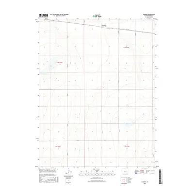
2016 Map of Hawkins
USGS Topo · Published 2016About this map
Hawkins sits in the northern reaches of this High Plains landscape, a small settlement defined by its position along the east-west corridor in Kiowa County. The terrain is characterized by subtle depressions that catch seasonal water, most notably at Salt Lake and the marshy expanses of Black Lake. These features provide a sharp contrast to the surrounding section lines that impose a rigid grid on the arid environment.
Find a feature on this map
17 named features on this map. Tap any name to fly to it.
Don’t see what you’re looking for? This feature index may not catch every label — zoom into the map to look around manually.
Map Details
Editions of this 2016 Hawkins Map
This is the sole edition of this map. No revisions or reprints were ever made.
Other maps of this area

1891 · Arroyo
USGS Topo · 1:125,000

1891 · Kit Carson
USGS Topo · 1:125,000

1891 · Las Animas
USGS Topo · 1:125,000

1892 · Lamar
USGS Topo · 1:125,000

1893 · Arroyo
USGS Topo · 1:125,000

1893 · Kit Carson
USGS Topo · 1:125,000

1893 · Las Animas
USGS Topo · 1:125,000

1954 · Lamar
USGS Topo · 1:250,000

1958 · Lamar
USGS Topo · 1:250,000

1968 · Rose Ranch
USGS Topo · 1:24,000