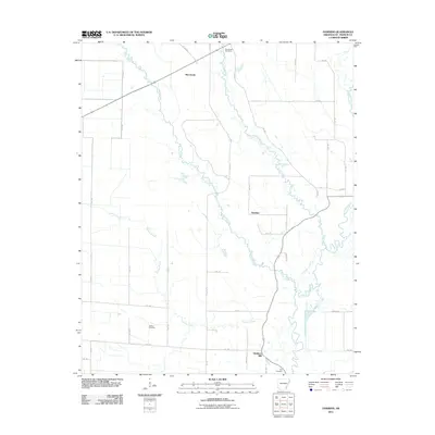
2011 Map of Hawkins
USGS Topo · Published 2011About this map
Slonikers Mill and the surrounding drainage of the L'Anguille River anchor this St. Francis County landscape in the early 21st century. The map details a rural area defined by a web of county roads and meandering waterways, including Second Creek and First Creek. Small community centers like Macedonia and Hawkins represent the localized settlement patterns of this Delta region, while several family or community burial grounds, such as Barnishaw Cemetery, Gaston Cemetery, and Bell Cemetery, provide valuable anchor points for genealogists and local historians. The intricate network of creeks, such as Cypress Creek and Spybuck Creek, underscores the agricultural character of the terrain, where water management and road access have historically dictated the placement of homesteads and small-scale industry.
Find a feature on this map
44 named features on this map. Tap any name to fly to it.
Don’t see what you’re looking for? This feature index may not catch every label — zoom into the map to look around manually.
Map Details
Editions of this 2011 Hawkins Map
This is the sole edition of this map. No revisions or reprints were ever made.
Other maps of this area

1939 · Wynne
USGS Topo · 1:62,500

1939 · Hunter
USGS Topo · 1:62,500

1940 · Brinkley
USGS Topo · 1:62,500

1940 · Marianna
USGS Topo · 1:62,500

1948 · Helena
USGS Topo · 1:250,000

1950 · Helena
USGS Topo · 1:250,000

1953 · Memphis
USGS Topo · 1:250,000

1955 · Helena
USGS Topo · 1:250,000

1956 · Memphis
USGS Topo · 1:250,000

1956 · Hunter
USGS Topo · 1:62,500