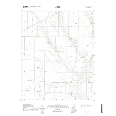
2020 Map of Hawkins
USGS Topo · Published 2020About this map
L'Anguille River and its dense network of tributaries, including Second Creek, First Creek, and Cypress Cr, dominate this section of St. Francis County. The settlement pattern is defined by rural junctions such as Hawkins and Slonikers Mill, reflecting a landscape built around agricultural drainage and early transport routes. A notable piece of regional history is preserved in the alignment of Old Military Rd W in the northern portion of the survey, a route that historically connected the Mississippi River to the interior of Arkansas. Small family and community landmarks are scattered throughout the township lines, including Barnishaw Cem, Stanley Grove Cem, Gaston Cem, and Bell Cem. The grid of county roads and named routes like Slonikers Mill Rd provide a framework for genealogists to locate ancestral homesteads within the established sections of T6N and T5N.
Find a feature on this map
51 named features on this map. Tap any name to fly to it.
Don’t see what you’re looking for? This feature index may not catch every label — zoom into the map to look around manually.
Map Details
Editions of this 2020 Hawkins Map
This is the sole edition of this map. No revisions or reprints were ever made.
Other maps of this area

1939 · Wynne
USGS Topo · 1:62,500

1939 · Hunter
USGS Topo · 1:62,500

1940 · Brinkley
USGS Topo · 1:62,500

1940 · Marianna
USGS Topo · 1:62,500

1948 · Helena
USGS Topo · 1:250,000

1950 · Helena
USGS Topo · 1:250,000

1953 · Memphis
USGS Topo · 1:250,000

1955 · Helena
USGS Topo · 1:250,000

1956 · Memphis
USGS Topo · 1:250,000

1956 · Hunter
USGS Topo · 1:62,500