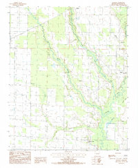
1984 Map of Hawkins
USGS Topo · Published 1985About this map
The L'Anguille River lowlands in St. Francis County define this landscape, where a dense network of natural waterways and man-made Irr Canals support the region's agricultural character. Small rural hubs such as Hawkins and Pinetree are joined by the site of Slonikers Mill, a notable local landmark positioned near the river's winding course. The map reveals the intricate drainage patterns of the Delta, with First Creek, Second Creek, and Cypress Creek carving paths through the terrain toward the main river channel.
Find a feature on this map
13 named features on this map. Tap any name to fly to it.
Don’t see what you’re looking for? This feature index may not catch every label — zoom into the map to look around manually.
Map Details
Editions of this 1984 Hawkins Map
This is the sole edition of this map. No revisions or reprints were ever made.
Other maps of this area

1939 · Wynne
USGS Topo · 1:62,500

1939 · Hunter
USGS Topo · 1:62,500

1940 · Brinkley
USGS Topo · 1:62,500

1940 · Marianna
USGS Topo · 1:62,500

1948 · Helena
USGS Topo · 1:250,000

1950 · Helena
USGS Topo · 1:250,000

1953 · Memphis
USGS Topo · 1:250,000

1955 · Helena
USGS Topo · 1:250,000

1956 · Memphis
USGS Topo · 1:250,000

1956 · Hunter
USGS Topo · 1:62,500