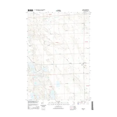
2014 Map of Hawks
USGS Topo · Published 2014About this map
The unincorporated community of Hawks serves as a local focal point in this portion of Presque Isle County, where the landscape is defined by an extensive network of inland lakes and glacial waterways. To the northwest, the small settlement of Big Cut sits near the headwaters of Fox Cr, while the larger Ocqueoc River and Little Ocqueoc River drain the northern reaches of the territory. The map reveals a high density of water bodies, from the larger Lake Nettie and Lake Emma in the southwest to more secluded spots like Lost Lake and Bear Lake. Genealogists will find three distinct burial grounds clustered near the main settlements, including the Bismarck Township Cem, Hope Cem, and Faith Cem. A grid of rural routes, such as W 638 Hwy and Noffze Hwy, connects these isolated communities and family-named landmarks across the Moltke Township area.
Find a feature on this map
60 named features on this map. Tap any name to fly to it.
Don’t see what you’re looking for? This feature index may not catch every label — zoom into the map to look around manually.
Map Details
Editions of this 2014 Hawks Map
This is the sole edition of this map. No revisions or reprints were ever made.
Other maps of this area

1954 · Alpena
USGS Topo · 1:250,000

1955 · Atlanta
USGS Topo · 1:62,500

1955 · Hillman
USGS Topo · 1:62,500

1955 · Cheboygan
USGS Topo · 1:250,000

1957 · Alpena
USGS Topo · 1:250,000

1957 · Onaway
USGS Topo · 1:62,500

1958 · Cheboygan
USGS Topo · 1:250,000

1958 · Alpena
USGS Topo · 1:250,000

1969 · Alpena
USGS Topo · 1:250,000

1971 · Rogers City
USGS Topo · 1:24,000