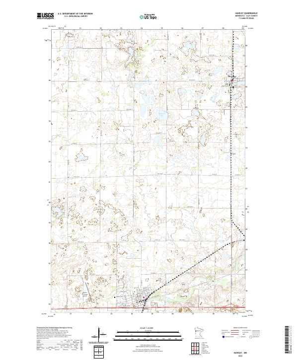
2022 Map of Hawley
USGS Topo · Published 2022About this map
The Buffalo River winds through this Clay County landscape, marking the southern reaches of the quadrangle near the city of Hawley. This area serves as a significant crossroads for regional travel and transport, featuring Old Hwy 2 and Main St which anchor the local grid. To the north, the smaller settlement of Hitterdal sits amidst a distinct collection of prairie potholes and wetlands, including Solwald Lake.
Find a feature on this map
39 named features on this map. Tap any name to fly to it.
Don’t see what you’re looking for? This feature index may not catch every label — zoom into the map to look around manually.
Map Details
Editions of this 2022 Hawley Map
This is the sole edition of this map. No revisions or reprints were ever made.
Other maps of this area

1918 · Flom
USGS Topo · 1:62,500

1918 · Ulen
USGS Topo · 1:62,500

1919 · Hawley
USGS Topo · 1:62,500

1952 · Grand Forks
USGS Topo · 1:250,000

1953 · Fargo
USGS Topo · 1:250,000

1956 · Fargo
USGS Topo · 1:250,000

1956 · Grand Forks
USGS Topo · 1:250,000

1966 · Grand Forks
USGS Topo · 1:250,000
1966 · Tilde Lake
USGS Topo · 1:24,000
1966 · Ulen
USGS Topo · 1:24,000