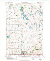
1966 Map of Hawley
USGS Topo · Published 1967About this map
Hitterdal and the larger settlement of Hawley anchor this mid-1960s survey of Clay County, defined by the glacial pothole lakes and wetlands of the Red River Valley’s eastern edge. The Northern Pacific railroad cuts through the landscape, dictating the development of these prairie towns and providing a corridor through Goose Prairie and Highland Grove. The map reveals a transition from managed conservation lands, such as the Cromwell State Wildlife Management Area, to active resource extraction indicated by several Gravel Pits near the Buffalo River.
Find a feature on this map
28 named features on this map. Tap any name to fly to it.
Don’t see what you’re looking for? This feature index may not catch every label — zoom into the map to look around manually.
Map Details
Editions of this 1966 Hawley Map
This is the sole edition of this map. No revisions or reprints were ever made.
Other maps of this area

1918 · Flom
USGS Topo · 1:62,500

1918 · Ulen
USGS Topo · 1:62,500

1919 · Hawley
USGS Topo · 1:62,500

1952 · Grand Forks
USGS Topo · 1:250,000

1953 · Fargo
USGS Topo · 1:250,000

1956 · Fargo
USGS Topo · 1:250,000

1956 · Grand Forks
USGS Topo · 1:250,000

1966 · Grand Forks
USGS Topo · 1:250,000
1966 · Tilde Lake
USGS Topo · 1:24,000
1966 · Ulen
USGS Topo · 1:24,000