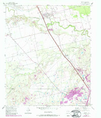
1957 Map of Hawley
USGS Topo · Published 1987About this map
The Clear Fork Brazos River snakes through this Texas landscape, forming a natural boundary near the town of Hawley. This area, updated with photorevisions into the late 1980s, reveals a mix of petroleum infrastructure and traditional ranching terrain. Industrial markers like the Cosden Refinery and various gravel operations sit alongside local landmarks such as the Hawley Cem and Mid Way Cem, offering essential data points for family historians.
Find a feature on this map
19 named features on this map. Tap any name to fly to it.
Don’t see what you’re looking for? This feature index may not catch every label — zoom into the map to look around manually.
Map Details
Editions of this 1957 Hawley Map
4 editions found
Other maps of this area

1890 · Abilene
USGS Topo · 1:125,000

1891 · Anson
USGS Topo · 1:125,000

1892 · Abilene
USGS Topo · 1:125,000

1893 · Anson
USGS Topo · 1:125,000

1954 · Abilene
USGS Topo · 1:250,000

1957 · Hawley
USGS Topo · 1:62,500

1957 · Kirby Lake
USGS Topo · 1:62,500

1957 · Abilene West
USGS Topo · 1:24,000

1957 · Abilene East
USGS Topo · 1:24,000

1957 · Nugent
USGS Topo · 1:62,500