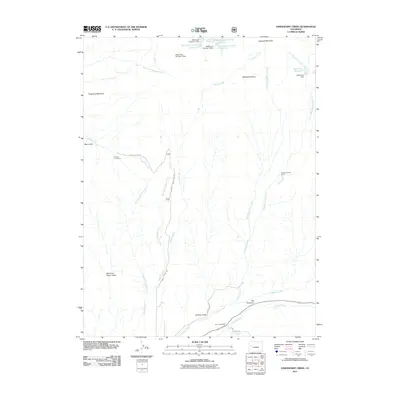
2011 Map of Hawxhurst Creek
USGS Topo · Published 2011About this map
Battlement Mesa dominates the northern landscape of this Colorado high-country survey, defining a drainage system that feeds into the Plateau Creek valley. The map documents an environment shaped by water management and ranching, evidenced by a series of high-altitude reservoirs such as Battlement Number 2 Reservoir and Hawxhurst Reservoir. These sources are critical for the seasonal grazing operations centered around remote outposts like Kennon Cow Camp and Hawxhurst Cow Camp. In the southern portion of the sheet, the convergence of Buzzard Creek and Plateau Creek creates a focus for local infrastructure, where Buzzard Creek Rd follows the water and the Clover Cemetery serves as a small but significant site of local heritage. The terrain transitions from the prominent peaks of Haystack Mountain and Sugarloaf Mountain down through deeply cut drainages like Smalley Gulch and Bear Gulch, illustrating the complex hydrology of the Mesa County backcountry.
Find a feature on this map
31 named features on this map. Tap any name to fly to it.
Don’t see what you’re looking for? This feature index may not catch every label — zoom into the map to look around manually.
Map Details
Editions of this 2011 Hawxhurst Creek Map
This is the sole edition of this map. No revisions or reprints were ever made.
Other maps of this area

1929 · Grand Valley
USGS Topo · 1:62,500

1955 · Collbran
USGS Topo · 1:24,000

1955 · Molina
USGS Topo · 1:24,000

1955 · The Meadows
USGS Topo · 1:24,000

1956 · Grand Junction
USGS Topo · 1:250,000

1957 · Leadville
USGS Topo · 1:250,000

1959 · Grand Junction
USGS Topo · 1:250,000

1959 · Leadville
USGS Topo · 1:250,000

1960 · Leadville
USGS Topo · 1:250,000

1960 · Grand Junction
USGS Topo · 1:250,000