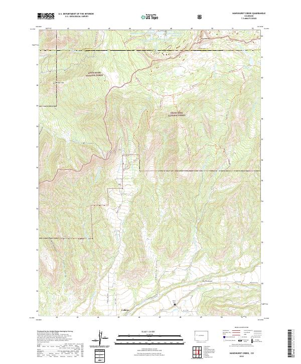
2022 Map of Hawxhurst Creek
USGS Topo · Published 2022About this map
Collbran sits at the southern base of a dramatic mountain landscape where the White River National Forest meets the Grand Mesa National Forest. The geography is defined by a series of steep drainages, including Smalley Gulch, Clover Gulch, and Bear Gulch, which feed into the valley floor of Plateau Cr. A sophisticated network of high-altitude water management is visible along the northern boundary, featuring the Battlement Number 1 Reservoir and several numbered sister reservoirs near the Garfield and Mesa county line.
Find a feature on this map
50 named features on this map. Tap any name to fly to it.
Don’t see what you’re looking for? This feature index may not catch every label — zoom into the map to look around manually.
Map Details
Editions of this 2022 Hawxhurst Creek Map
This is the sole edition of this map. No revisions or reprints were ever made.
Other maps of this area

1929 · Grand Valley
USGS Topo · 1:62,500

1955 · Collbran
USGS Topo · 1:24,000

1955 · Molina
USGS Topo · 1:24,000

1955 · The Meadows
USGS Topo · 1:24,000

1956 · Grand Junction
USGS Topo · 1:250,000

1957 · Leadville
USGS Topo · 1:250,000

1959 · Grand Junction
USGS Topo · 1:250,000

1959 · Leadville
USGS Topo · 1:250,000

1960 · Leadville
USGS Topo · 1:250,000

1960 · Grand Junction
USGS Topo · 1:250,000