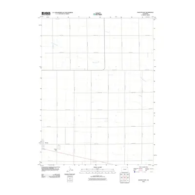
2010 Map of Haxtun East
USGS Topo · Published 2010About this map
Haxtun occupies the southwestern edge of this agricultural landscape in Phillips County, marking a clear point of transition from town to the vast, grid-based farming sections of eastern Colorado. The surrounding topography is defined by the ephemeral drainage of Wildhorse Creek, which winds through the northeastern portion of the quadrangle. The map illustrates a highly organized rural infrastructure, dominated by an extensive network of thoroughfares such as County RD-42 and County RD-7. These roads delineate the section lines typical of High Plains settlement patterns, supporting the movement of goods and machinery between the municipal center and outlying ranching or farming operations. For those researching the evolution of rural development, the precise alignment of roads like County RD-30 and County RD-28 highlights the enduring structure of the region's land management and transportation history.
Find a feature on this map
18 named features on this map. Tap any name to fly to it.
Don’t see what you’re looking for? This feature index may not catch every label — zoom into the map to look around manually.
Map Details
Editions of this 2010 Haxtun East Map
This is the sole edition of this map. No revisions or reprints were ever made.
Other maps of this area

1952 · Julesburg SW
USGS Topo · 1:24,000

1952 · Marks Butte
USGS Topo · 1:24,000

1953 · Tamarack Ranch
USGS Topo · 1:24,000

1954 · Sterling
USGS Topo · 1:250,000

1958 · Sterling
USGS Topo · 1:250,000

1962 · Haxtun East
USGS Topo · 1:24,000

1962 · Haxtun West
USGS Topo · 1:24,000

1962 · Holyoke NW
USGS Topo · 1:24,000

1971 · Paoli
USGS Topo · 1:24,000

1971 · Haxtun SE
USGS Topo · 1:24,000