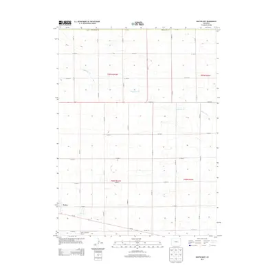
2013 Map of Haxtun East
USGS Topo · Published 2013About this map
Haxtun serves as the focal point of this agricultural landscape in eastern Phillips County, Colorado. The terrain is defined by a rhythmic grid of rural routes, including Co-59 and Us-6 W, which intersect at the southeastern edge of the settlement. These roads partition the plains into township and range sections, reflecting the enduring legacy of the Public Land Survey System. Wildhorse Creek meanders across the northern and eastern portions of the map, carving subtle drainage patterns through the high plains topography. Outside the immediate residential area of Haxtun, the Haxtun Municipal Airport occupies the southern fringe, underscoring the importance of aerial connectivity for this isolated farming community. The map provides a precise look at the 2013 footprint of the town and its surrounding section roads, such as Co Road 30 and Co Road 2.
Find a feature on this map
26 named features on this map. Tap any name to fly to it.
Don’t see what you’re looking for? This feature index may not catch every label — zoom into the map to look around manually.
Map Details
Editions of this 2013 Haxtun East Map
This is the sole edition of this map. No revisions or reprints were ever made.
Other maps of this area

1952 · Julesburg SW
USGS Topo · 1:24,000

1952 · Marks Butte
USGS Topo · 1:24,000

1953 · Tamarack Ranch
USGS Topo · 1:24,000

1954 · Sterling
USGS Topo · 1:250,000

1958 · Sterling
USGS Topo · 1:250,000

1962 · Haxtun East
USGS Topo · 1:24,000

1962 · Haxtun West
USGS Topo · 1:24,000

1962 · Holyoke NW
USGS Topo · 1:24,000

1971 · Paoli
USGS Topo · 1:24,000

1971 · Haxtun SE
USGS Topo · 1:24,000