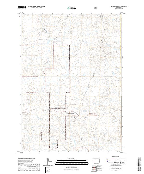
2021 Map of Hay Canyon Butte
USGS Topo · Published 2021About this map
Buffalo Gap National Grassland dominates the southeastern quadrant of this prairie landscape, providing a stark contrast to the surveyed sections of Fall River County. The terrain is defined by the White River Divide, a prominent ridge that separates local drainage systems. To the west, Hay Canyon and its associated Bockert Reservoir drain toward the north, while the southern reaches are etched by the courses of Rock Butte Cr, Kennedy Cr, and the descriptively named West Kneebone Draw.
Find a feature on this map
18 named features on this map. Tap any name to fly to it.
Don’t see what you’re looking for? This feature index may not catch every label — zoom into the map to look around manually.
Map Details
Editions of this 2021 Hay Canyon Butte Map
This is the sole edition of this map. No revisions or reprints were ever made.
Other maps of this area

1896 · Oelrichs
USGS Topo · 1:125,000

1900 · Oelrichs
USGS Topo · 1:125,000

1951 · Willow Creek NW
USGS Topo · 1:24,000

1951 · Smithwick NE
USGS Topo · 1:24,000

1951 · Smithwick NW
USGS Topo · 1:24,000

1955 · Hot Springs
USGS Topo · 1:250,000

1967 · Slim Butte NW
USGS Topo · 1:24,000

1967 · Willow Creek SW
USGS Topo · 1:24,000
1982 · Smithwick
USGS Topo · 1:25,000
1982 · Hay Canyon Butte
USGS Topo · 1:25,000