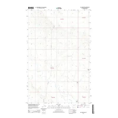
2014 Map of Hay Creek NW
USGS Topo · Published 2014About this map
Poplar River meanders across this northern Montana landscape, defining the drainage patterns of Roosevelt County. The terrain is marked by significant topographical shifts, most notably at Swank Coulee which cuts through the eastern portion of the quadrangle. This 2014 survey captures a sparsely populated region of the Poplar District where aviation and local transport rely on features like the Swank Airport, situated near the coulee that shares its name. The mapping shows a network of watercourses including Lone Tree Cr and Short Cr, which feed into the primary river valley. Connectivity across these townships is maintained by rural routes such as W Poplar Rd and Poplar River Rd, providing a clear view of the infrastructure supporting this expansive ranching and prairie environment during the early 21st century.
Find a feature on this map
14 named features on this map. Tap any name to fly to it.
Don’t see what you’re looking for? This feature index may not catch every label — zoom into the map to look around manually.
Map Details
Editions of this 2014 Hay Creek NW Map
This is the sole edition of this map. No revisions or reprints were ever made.
Other maps of this area

1910 · Cuskers
USGS Topo · 1:62,500

1912 · Hay Creek
USGS Topo · 1:62,500

1915 · Cuskers
USGS Topo · 1:62,500

1954 · Wolf Point
USGS Topo · 1:250,000

1958 · Wolf Point
USGS Topo · 1:250,000

1973 · Bredette
USGS Topo · 1:24,000

1973 · Pleasant Prairie
USGS Topo · 1:24,000

1973 · Pleasant Prairie SW
USGS Topo · 1:24,000
1983 · Hay Creek NW
USGS Topo · 1:24,000
1983 · Long Creek West
USGS Topo · 1:24,000