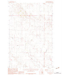
1983 Map of Hay Creek NW
USGS Topo · Published 1983About this map
Poplar River winds through this corner of the Fort Peck Indian Reservation, creating a complex drainage network within the Missouri River watershed. This 1983 provisional survey captures a landscape defined by its hydrography, where the main river is fed by numerous secondary waterways like Lone Tree Creek and Short Creek. The topography is marked by deeply incised features such as Swank Coulee, which illustrate the erosion patterns characteristic of northeastern Montana. The lack of named settlements or schools on this sheet emphasizes the pastoral and open nature of the terrain during the late 1970s and early 1980s, primarily serving as rangeland within Roosevelt County. The map also delineates the southern reaches of Hay Creek, providing a detailed record of the natural contours and seasonal watercourses that shaped the rural economy and land use of the period.
Find a feature on this map
8 named features on this map. Tap any name to fly to it.
Don’t see what you’re looking for? This feature index may not catch every label — zoom into the map to look around manually.
Map Details
Editions of this 1983 Hay Creek NW Map
This is the sole edition of this map. No revisions or reprints were ever made.
Other maps of this area

1910 · Cuskers
USGS Topo · 1:62,500

1912 · Hay Creek
USGS Topo · 1:62,500

1915 · Cuskers
USGS Topo · 1:62,500

1954 · Wolf Point
USGS Topo · 1:250,000

1958 · Wolf Point
USGS Topo · 1:250,000

1973 · Bredette
USGS Topo · 1:24,000

1973 · Pleasant Prairie
USGS Topo · 1:24,000

1973 · Pleasant Prairie SW
USGS Topo · 1:24,000
1983 · Long Creek West
USGS Topo · 1:24,000
1983 · Long Creek East
USGS Topo · 1:24,000