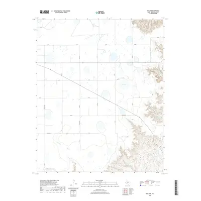
2019 Map of Hay Lake
USGS Topo · Published 2019About this map
Hay Lake and the surrounding high plains of Briscoe County are defined by a network of seasonal watercourses and playa lakes that drain toward the Caprock Escarpment. This 2019 survey documents a landscape where traditional ranching infrastructure, such as Holmes Cr Tank, intersects with a modern grid of county roads. The drainage systems of Los Lingos Cr and the North Fork Red River provide significant topographical relief against the flatter agricultural and grazing lands. These creek beds, including Big Cottonwood Cr and Little Cottonwood Cr, reveal the complex erosion patterns that characterize the transition from the Llano Estacado into the canyonlands to the east. The map captures the current layout of local transport, dominated by routes like Ranch Rd 145 and Ranch Rd 2464, which facilitate movement through this sparsely populated cattle-country terrain.
Find a feature on this map
26 named features on this map. Tap any name to fly to it.
Don’t see what you’re looking for? This feature index may not catch every label — zoom into the map to look around manually.
Map Details
Editions of this 2019 Hay Lake Map
This is the sole edition of this map. No revisions or reprints were ever made.
Other maps of this area

1954 · Plainview
USGS Topo · 1:250,000

1958 · Plainview
USGS Topo · 1:250,000

1960 · Indian Peak
USGS Topo · 1:62,500

1965 · Ross Canyon
USGS Topo · 1:24,000

1965 · Whiteley
USGS Topo · 1:24,000

1965 · Silverton
USGS Topo · 1:24,000

1967 · Quitaque
USGS Topo · 1:24,000

1967 · Edgemon Lake
USGS Topo · 1:24,000

1967 · Hay Lake
USGS Topo · 1:24,000

1967 · Lake Theo
USGS Topo · 1:24,000