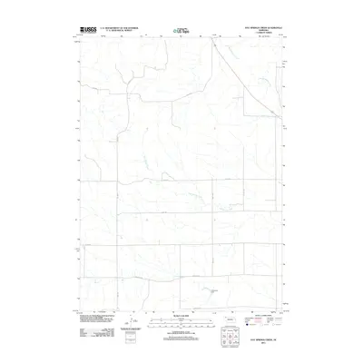
2011 Map of Hay Springs Creek
USGS Topo · Published 2011About this map
Hay Springs Creek and Little Bordeaux Creek define the drainage of this Dawes County landscape, where the terrain is organized by a strict grid of section lines and rural thoroughfares. The property boundaries and transit patterns of the early 21st century are clear through named routes like Long Rd, Egan Rd, and Co Line Rd, which demarcate the agricultural parcels. To the south, Anderson Dam manages local water resources, while the presence of Table Rd and Antelope Rd reflects the naming conventions of this high plains cattle and grain country. This survey by the U.S. Geological Survey preserves the specific layout of Nebraska's rural infrastructure, from the local section-line crossings to the specific waterway bends that have shaped land ownership in the region.
Find a feature on this map
12 named features on this map. Tap any name to fly to it.
Don’t see what you’re looking for? This feature index may not catch every label — zoom into the map to look around manually.
Map Details
Editions of this 2011 Hay Springs Creek Map
This is the sole edition of this map. No revisions or reprints were ever made.
Other maps of this area

1955 · Alliance
USGS Topo · 1:250,000

1957 · Alliance
USGS Topo · 1:250,000

1958 · Alliance
USGS Topo · 1:250,000

1960 · Hay Springs SW
USGS Topo · 1:24,000

1966 · Chadron 3 SE
USGS Topo · 1:24,000

1966 · Hay Springs
USGS Topo · 1:24,000

1966 · Chadron 3 NE
USGS Topo · 1:24,000
1966 · Chadron 3 SW
USGS Topo · 1:24,000

1969 · Bordeaux
USGS Topo · 1:24,000
1969 · Whiteclay SW
USGS Topo · 1:24,000