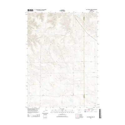
2014 Map of Hay Springs Creek
USGS Topo · Published 2014About this map
The rolling high plains of the Nebraska Panhandle are defined here by the winding course of Hay Springs Cr as it carves through the landscape of Dawes and Sheridan Counties. This 2014 survey documents a rural agricultural environment structured by a precise grid of section-line roads, including Table Rd and Antelope Rd, which provide access to isolated farmsteads and ranch lands. To the north, the headwaters of Little Bordeaux Cr flow toward the White River drainage, while the southern portion of the quadrangle features the Anderson Reservoir. The map reveals the persistent influence of family-named landmarks on the local geography, with routes like Speirs Rd, Carlson Rd, and Krotz Rd serving as modern links to the area's ranching heritage and early settlement patterns.
Find a feature on this map
18 named features on this map. Tap any name to fly to it.
Don’t see what you’re looking for? This feature index may not catch every label — zoom into the map to look around manually.
Map Details
Editions of this 2014 Hay Springs Creek Map
This is the sole edition of this map. No revisions or reprints were ever made.
Other maps of this area

1955 · Alliance
USGS Topo · 1:250,000

1957 · Alliance
USGS Topo · 1:250,000

1958 · Alliance
USGS Topo · 1:250,000

1960 · Hay Springs SW
USGS Topo · 1:24,000

1966 · Chadron 3 SE
USGS Topo · 1:24,000

1966 · Hay Springs
USGS Topo · 1:24,000

1966 · Chadron 3 NE
USGS Topo · 1:24,000
1966 · Chadron 3 SW
USGS Topo · 1:24,000

1969 · Bordeaux
USGS Topo · 1:24,000
1969 · Whiteclay SW
USGS Topo · 1:24,000