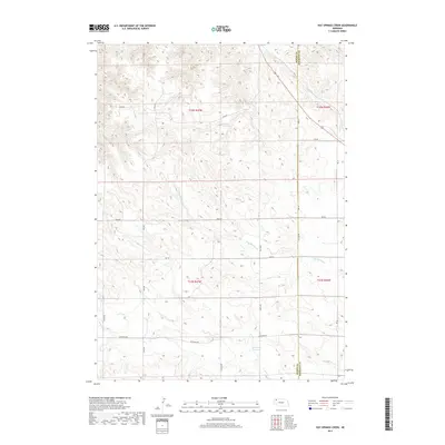
2017 Map of Hay Springs Creek
USGS Topo · Published 2017About this map
Hay Springs Creek and its drainage network define this expanse of the Nebraska Panhandle, where the high plains meet the divide between Dawes and Sheridan Counties. This 2017 survey by the U.S. Geological Survey illustrates a landscape of large-scale ranching and agriculture, structured by a rigid section-line road network. To the north, Little Bordeaux Creek cuts through the terrain, while the southern reaches feature the Anderson Reservoir. Family-named routes such as Carlson Rd, Krotz Rd, and Speirs Rd connect the isolated homesteads and grazing lands. The geography is marked by its transition from the tablelands of Table Rd to the creek valleys, providing a contemporary view of the region's enduring rural character and the persistence of early land division systems like those seen in t32n r47w and t31n r46w.
Find a feature on this map
21 named features on this map. Tap any name to fly to it.
Don’t see what you’re looking for? This feature index may not catch every label — zoom into the map to look around manually.
Map Details
Editions of this 2017 Hay Springs Creek Map
This is the sole edition of this map. No revisions or reprints were ever made.
Other maps of this area

1955 · Alliance
USGS Topo · 1:250,000

1957 · Alliance
USGS Topo · 1:250,000

1958 · Alliance
USGS Topo · 1:250,000

1960 · Hay Springs SW
USGS Topo · 1:24,000

1966 · Chadron 3 SE
USGS Topo · 1:24,000

1966 · Hay Springs
USGS Topo · 1:24,000

1966 · Chadron 3 NE
USGS Topo · 1:24,000
1966 · Chadron 3 SW
USGS Topo · 1:24,000

1969 · Bordeaux
USGS Topo · 1:24,000
1969 · Whiteclay SW
USGS Topo · 1:24,000